Speightstown
Speightstown, also known as Little Bristol, is the second largest City centre of Barbados. It is situated 12 mi north of the capital city of Bridgetown, in the northern parish of Saint Peter.
The City is named after William Speight, a member of Barbados' first Assembly during the Settlement years, and the former owner of the land where the City is located.
Speightstown was formally settled around 1630 and in the earliest days of Settlement was Barbados's busiest port (AMS Seaport Code: 27213, UN/LOCODE: BB SPT ). Ships laden with sugar and other commodities left Speightstown bound directly for London and especially Bristol. For this reason Speightstown is sometimes known as Little Bristol. The quaint town has now become the centre of a tourist area as well as a secondary shopping centre.
The town itself is currently the subject of an archaeological research project, the Speightstown Community Archaeology Project (SCAP), which was established in 2010 and involves a collaboration between archaeologists and students of the University of Winchester, the University of the West Indies (Cave Hill) and Barbados Museums. To date work has focused upon an historic buildings categorisation of the town, graveyard memorial survey and excavations at the eighteenth-century coastal fort at Maycock's Bay to the north.
Map - Speightstown
Map
Country - Barbados
 |
 |
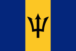
| Flag of Barbados | |
Inhabited by Kalinago people since the 13th century, and prior to that by other Amerindians, Spanish navigators took possession of Barbados in the late 15th century, claiming it for the Crown of Castile. It first appeared on a Spanish map in 1511. The Portuguese Empire claimed the island between 1532 and 1536, but abandoned it in 1620 with their only remnants being an introduction of wild boars for a good supply of meat whenever the island was visited. An English ship, the Olive Blossom, arrived in Barbados on 14 May 1625; its men took possession of the island in the name of King James I. In 1627, the first permanent settlers arrived from England, and Barbados became an English and later British colony. During this period, the colony operated on a plantation economy, relying on the labour of African slaves who worked on the island's plantations. Slavery continued until it was phased out through most of the British Empire by the Slavery Abolition Act 1833.
Currency / Language
| ISO | Currency | Symbol | Significant figures |
|---|---|---|---|
| BBD | Barbados dollar | $ | 2 |
| USD | United States dollar | $ | 2 |
| ISO | Language |
|---|---|
| EN | English language |


